
Ardèche · about 3 km from Ruoms
Baume du Pêcher
- Max depth33 m
- CertificationFull cave
- Water temperature≈ 12–13 °Cestimated, no reports yet
- SpecialSidemount
Diving and fills
Dive here with
No dive centre guides here yet. Do you dive here with guests? Add your centre for free →
What it looks like
All 1 videos and posts
Videos and posts
From other divers, via YouTube, Instagram and Facebook. They only load when you click; after that, Google's or Meta's privacy rules apply.
Search for more onYouTube ↗Instagram ↗Facebook ↗
Other people's footage, not advice: how someone else dives here says nothing about what suits your team. Dive within your training.
The dive
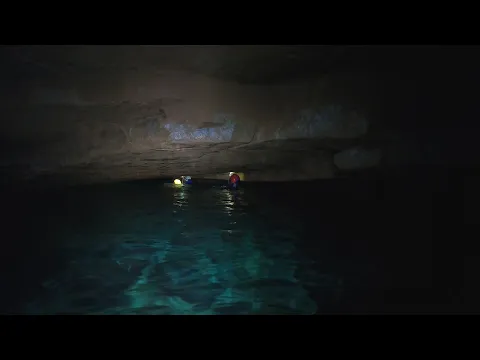
A long resurgence with a string of short sumps alternating with dry passage. Around 400 m there is a wet duck and at 450 m a lake; a northern branch has three sumps (up to 55 m / -25).
Profile and sections
A long resurgence with a string of short sumps alternating with dry passage. Around 400 m there is a wet duck and at 450 m a lake; a northern branch has three sumps (up to 55 m / -25). Beyond S10 the ceilings are over 10 m high.
Explored 1945–2008: G.S. Vans reached S10 in 1980–82, and Baudu's team got past the terminal sump in 2008.
- Depth and profile
- S1 20 m (starts with a narrow window) · S2 no data · S3 13 m / -3 · S4 183 m / -22 (at 735 m) · S5 60 m / -25 (can be bypassed by a climb) · S6 40 m / -6 · S7 55 m / -10 · S8 30 m / -4 · S9 40 m / -6 · S10 120 m / -33 · development 2,623 m, entrance to end 2,225 m
- Configuration
- Small, light sidemount: narrow S1 entrance, meanders and many dry sections with climbing (5–8 m aid climb between S4 and S5, 10 m climb at S9). Backmount not suitable (estimate).
- DPV: Not DPV-suitable (estimate)
- Short sumps with dry sections in between: no scooter.
Who can dive where
- At least Full cave
- Configurations: Sidemount / CCR / Small cylinders / no-mount (speleo sumps)
- Goes down to 33 m (trimix or deco may be needed)
- Experienced divers only
This is how the planner decides who in your team may dive this cave. Rules your own trip adds (organizer, a mail, the AI) show with your trip.
How to get there
Right bank of the Ligne, below the D4 Bellevue–Ruoms road, about 500 m south of the Bellevue road cutting. From a hairpin bend descend 10–20 m to the entrance among the rocks. Then 123 m of passage to S1.
Around Baume du Pêcher
FillsNo fill station known nearby
The links to Booking.com are affiliate links: if you book through one, DiveTripPlanner earns a small commission. You pay the same.
Going to the Ardèche with your team?
Marcel finds the sites that match your team's certifications.
Plan a trip