
Valbrenta · about 9 km from Chiusaforte
Fontanon di Goriuda
- CertificationFull cave
- Water temperature≈ 8–9 °Cestimated, no reports yet
- SpecialExperienced divers
Diving and fills
Dive here with
No dive centre guides here yet. Do you dive here with guests? Add your centre for free →
What it looks like
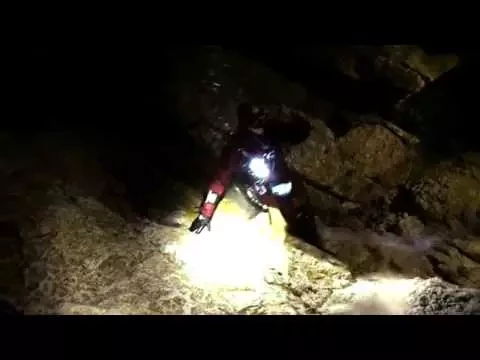
Fontanon di Goriuda - Night Cave Diving Cave Diving - Monte Canin - Fontanon di Goriuda - Speleosubacquea Carnica
All 2 videos and posts
Videos and posts
From other divers, via YouTube, Instagram and Facebook. They only load when you click; after that, Google's or Meta's privacy rules apply.
Fontanon di Goriuda - Night Cave Diving Cave Diving - Monte Canin - Fontanon di Goriuda - Speleosubacquea Carnica
Search for more onYouTube ↗Instagram ↗Facebook ↗
Other people's footage, not advice: how someone else dives here says nothing about what suits your team. Dive within your training.
The dive
A powerful spring returning the water of the Canin massif; geosite of national interest. It is an exploration cave, not a classic visitor dive.
Profile and sections
A powerful spring returning the water of the Canin massif; geosite of national interest. It is an exploration cave, not a classic visitor dive.
The Club Alpinistico Triestino (cave diver Duilio Cobol) has explored it for ~25 years: large fossil galleries in 2008–2009, a new link between S1 and S2 in July 2015, and sections with climbing and verticals of >100 m.
Practical: far from the Valbrenta (better from a Friuli base).
- Depth and profile
- Development 768 m, +119 m / -2 m (cadastre). Several sumps beyond the lake at ~150 m; sump lengths and depths not published.
- Configuration
- Sump diving with carrying. S2 was dived on a rebreather in 2015; no further data on configuration.
- DPV: Not DPV-suitable (estimate)
- Carrying and sumps between dry sections: no scooter (estimate).
Who can dive where
- At least Full cave
- Configurations: Backmount / twinset / Sidemount / CCR / Small cylinders / no-mount (speleo sumps)
- Configuration unknown — research beforehand
- Experienced divers only
This is how the planner decides who in your team may dive this cave. Rules your own trip adds (organizer, a mail, the AI) show with your trip.
How to get there
From the road in the Val Raccolana (near Pian della Sega) ~20 min on foot through beech forest to a large portal where the water flows out; the waterfall is visible from the road. After ~150 m of walking inside, a lake closes the passage: beyond that only by diving (or a small boat). All gear has to be carried in.
Around Fontanon di Goriuda
FillsNo fill station known nearby
The links to Booking.com are affiliate links: if you book through one, DiveTripPlanner earns a small commission. You pay the same.
Caves nearby1 within 41 km
Going to the Valbrenta with your team?
Marcel finds the sites that match your team's certifications.
Plan a trip