
Vercors · about 5 km from Pont-en-Royans
Lac des Grottes de Choranche
Closed to divers
Closed to divers: private show-cave land. The owner (Visites Nature Vercors) does not want this site listed as a dive site on DiveTripPlanner; you cannot dive here.
- CertificationCavern
Diving and fills
Dive here with
No dive centre guides here yet. Do you dive here with guests? Add your centre for free →
Now at Lac des Grottes de Choranche
What it looks like
All 2 videos and posts
Videos and posts
From other divers, via YouTube, Instagram and Facebook. They only load when you click; after that, Google's or Meta's privacy rules apply.
Search for more onYouTube ↗Instagram ↗Facebook ↗
Other people's footage, not advice: how someone else dives here says nothing about what suits your team. Dive within your training.
The dive
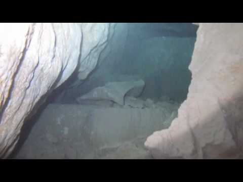
A flooded former cave entrance in the Choranche cirque, under water for more than 5,000 years. You dive among flowstone, stalactites and calcite gours, in clear water from the underground river.
Profile and sections
A flooded former cave entrance in the Choranche cirque, under water for more than 5,000 years. You dive among flowstone, stalactites and calcite gours, in clear water from the underground river.
Practical: the Choranche show cave (Visites Nature Vercors) is open all year.
- Depth and profile
- Depth and size not published; the lake lies at ~600 m altitude.
- Configuration
- Closed to divers.
Who can dive where
- At least Cavern
- Configurations: Backmount / twinset / Sidemount / CCR / Small cylinders / no-mount (speleo sumps)
This is how the planner decides who in your team may dive this cave. Rules your own trip adds (organizer, a mail, the AI) show with your trip.
How to get there
On the grounds of the Grottes de Choranche (show cave, Visites Nature Vercors), about a 10-minute walk from the car park. Private land.
Around Lac des Grottes de Choranche
FillsNo fill station known nearby
Caves nearby5 within 39 km
Going to the Vercors with your team?
Marcel finds the sites that match your team's certifications.
Plan a trip