
Ardèche · about 5 km from Saint-Remèze
Source du Platane
- Max depth67 m
- CertificationFull cave
- Water temperature≈ 12–13 °Cestimated, no reports yet
- SpecialSidemount
Diving and fills
Dive here with
No dive centre guides here yet. Do you dive here with guests? Add your centre for free →
What it looks like
All 2 videos and posts
Videos and posts
From other divers, via YouTube, Instagram and Facebook. They only load when you click; after that, Google's or Meta's privacy rules apply.
Search for more onYouTube ↗Instagram ↗Facebook ↗
Other people's footage, not advice: how someone else dives here says nothing about what suits your team. Dive within your training.
The dive
Visibility is rarely good: leaves and mud wash in from the river at the entrance, the water turns milky at the deepest point, and it gets worse in the fissure and on the way back (guide).
Profile and sections
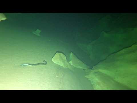
Visibility is rarely good: leaves and mud wash in from the river at the entrance, the water turns milky at the deepest point, and it gets worse in the fissure and on the way back (guide). There is a fine, slippery silt layer on the floor. The water is clearly warmer than the Ardèche, and there are fish (chub) and eels in the sump.
The spring is named after a plane tree in the crack above it. Explored since 1989 (C. Lucotte); 1995 -48 m, 2002 420 m, 2005 -66 m (RABA), 2009 750 m; new dives in 2017.
Practical: check the water level before going (vigicrues.gouv.fr).
- Depth and profile
- According to InDEPTH (2026) 67 m deep, ~1,300 m surveyed and an end point at ~1,253 m at the foot of a chimney. One long sump: pit just after the entrance · -48 m at ~100 m · 420 m / -60 · low point -66 m, then up to -8 m (620 m) · end point 750 m / -22 (2009). Per the guide: the entrance is only 60–70 cm high for the first 20 m; small pit at -10 m; large shaft from -23 to -43 m; on to -55 m and, past an arch that briefly splits the passage (~250 m from the exit), to -66 m; then up 12 m over 100 m to an almost vertical fissure, dived up to -4 m.
- Configuration
- Tight, muddy bedding plane at the entrance: sidemount or compact CCR (2017: small rebreather with bailout cylinders, wetsuit). No backmount (estimate).
- DPV: Not DPV-suitable (estimate)
- Tight, muddy entrance and poor visibility; despite the long sump little gain.
Who can dive where
- At least Full cave
- Configurations: Sidemount / CCR
- Goes down to 67 m (trimix or deco may be needed)
- Ropework (SRT) needed
- Experienced divers only
This is how the planner decides who in your team may dive this cave. Rules your own trip adds (organizer, a mail, the AI) show with your trip.
How to get there
Left bank, about 2 km downstream of the Dragonnière de Gaud, in the meander downstream of Autridge. The spring flows into the river from under a slanted limestone slab with a small plane tree with a strikingly thick trunk (hence the name); there is a gravel bank in front. From the D290 (gorge road) via an old, overgrown charcoal-burners' path down the combe d'Agrimont, with two rope sections (down the last rock band). Or by canoe from Vallon-Pont-d'Arc (half a day).
Around Source du Platane
FillsNo fill station known nearby
The links to Booking.com are affiliate links: if you book through one, DiveTripPlanner earns a small commission. You pay the same.
News
Access and rules change: check what applies locally right before your trip. Source: GDELT Project and the news feeds of diving magazines. Search for more news ↗ Searched automatically, last on 11 Nov 2026.
More of the latest in Ardèche (France): conditions, closures and news →Going to the Ardèche with your team?
Marcel finds the sites that match your team's certifications.
Plan a trip