
Lot · about 14 km from Marcilhac-sur-Célé
Igue de Planagrèze
Info · exploration
Information only: a caving expedition, not a dive site. The sumps lie beneath a 113 m to 184 m descent on ropes, and the igue is not on the CDS du Lot's list of sites where diving is allowed (November 2026). The Lot Filling Station map also lists it as a caving site only.
- Max depth89 m
- CertificationFull cave
- SpecialRopework
Diving and fills
Dive here with
No dive centre guides here yet. Do you dive here with guests? Add your centre for free →
Fills nearby
- The Cave To BeAir, nitrox and trimix up to 320 bar (standard 21/35, 18/45, 15/55, 10/50), O₂ up to 220 bar
- Lot Filling Station (Proteushop)Air, nitrox (any %), trimix (incl. 21/35, 18/45, 15/55, 10/70 and custom), O₂ 200/300 bar
Now at Igue de Planagrèze
What it looks like
All 1 videos and posts
Videos and posts
From other divers, via YouTube, Instagram and Facebook. They only load when you click; after that, Google's or Meta's privacy rules apply.
Search for more onYouTube ↗Instagram ↗Facebook ↗
Other people's footage, not advice: how someone else dives here says nothing about what suits your team. Dive within your training.
The dive
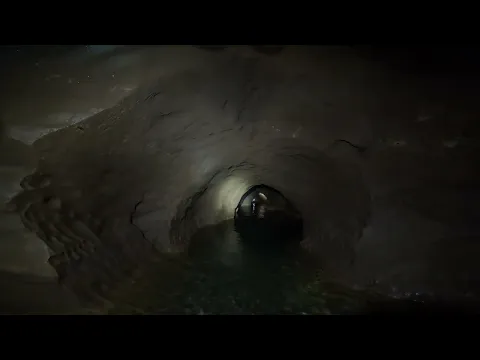
The entrance, about 6 by 3 m, opens onto a shaft of about 70 m. At the bottom you stand on a stony floor at -73 m; an 8 m step leads into the Salle de la Castine.
Profile and sections
The entrance, about 6 by 3 m, opens onto a shaft of about 70 m. At the bottom you stand on a stony floor at -73 m; an 8 m step leads into the Salle de la Castine. A second shaft of 43 m, the 'tuyau de poêle' that was once widened artificially, drops in many pitches to the Rivière suspendue at -113 m. Upstream this river runs through a phreatic tube that you follow for about 65 m by dinghy to the first of three sumps, with dry passages between them. S1 is a round tube about 3 to 4 m across that drops quickly down a 45° slope of pebbles and rises more gradually; the river has been explored for about 700 m.
Downstream the water vanishes into an impassable conduit; through a fissure above the big boulder under the P43 you reach a small, very wet network, explored in 1982. From the foot of the P43 the passage continues dry (except in big floods) to a last series of shafts: 65 m down to a deep lake at -184 m at low water, where there is nowhere to stand. That lake has been dived to 89 m deep over 130 m. The whole system is 1,542 m long and 275 m deep.
Practical: a trip takes 4 to 5 hours on average, without diving. In 2026 a team from the British CDG hauled ropes, dive kit and four 3-litre cylinders down to the Rivière suspendue.
- Depth and profile
- Descent: P70 to -73 m, through the Salle de la Castine (-83 m) and the P43 to the Rivière suspendue (-113 m). Upstream S1 120 m / -12 m (another CDS description: 110 m), S2 140 m / -3 m, S3 442 m / -58 m (impassable beyond). At the bottom a lake at -184 m (low water), dived to -89 m over 130 m; its floor is at -275 m.
- Configuration
- All dive kit goes down on ropes (a team in 2026 took 3-litre cylinders); upstream first ~65 m by dinghy to S1.
- Gas
- Trimix from 45 m
Who can dive where
- At least Full cave
- Configurations: Sidemount / Small cylinders / no-mount (speleo sumps)
- Goes down to 89 m (trimix or deco may be needed)
- Ropework (SRT) needed
- Experienced divers only
This is how the planner decides who in your team may dive this cave. Rules your own trip adds (organizer, a mail, the AI) show with your trip.
How to get there
Commune of Caniac-du-Causse. 2.5 km from Caniac on the road to Fontanes (D42), just after the bottom of the descent at the end of the long straight, take the marked path on the right; the igue is 400 m along it. Go right through the gap in the low wall: the igue opens at the bottom of a wooded funnel. It is on the IGN map.
Around Igue de Planagrèze
Fills2 fill stations · nearest 18 km
The Cave To Be
842 rue Émile Zola (D14, Bournazel), 46500 Gramat
Air, nitrox and trimix up to 320 bar (standard 21/35, 18/45, 15/55, 10/50), O₂ up to 220 bar
Open year-round (except between the end-of-year holidays), daily 8:30–19:00
Near Gramat, handy for the sites around Gramat and Padirac. Guided dives in 16 caves of the Lot, at your own certification level (air or nitrox without deco, or one trimix dive with deco). Also courses from cavern to full cave, sidemount, CCR and scooter, rental of overhead gear, a shop and accommodation. Contact: Olivier.
Lot Filling Station (Proteushop)
180 route de la Tuilerie, 46100 Cambes
Air, nitrox (any %), trimix (incl. 21/35, 18/45, 15/55, 10/70 and custom), O₂ 200/300 bar
Daily 9:30–19:30, year-round
About 20 min from the Ressel. Standard mixes ready to go; order custom blends in advance (WhatsApp). Also a dive shop (Proteushop), rental of scooters, lights and twinsets, and cave training (PSAI/TDI).
News
All (2)
Nearby
Articles about cave diving that name a place within 25 km of this site, but no cave by name. They're not necessarily about this site.
Access and rules change: check what applies locally right before your trip. Source: GDELT Project and the news feeds of diving magazines. Search for more news ↗ Searched automatically, last on 8 Nov 2026.
More of the latest in Lot (France): conditions, closures and news →Going to the Lot with your team?
Marcel finds the sites that match your team's certifications.
Plan a trip