
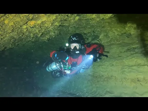
2 caves · down to 44 m
Cave diving in the Alto Tajo and the Serranía de Cuenca
- Caves2
- Max depth44 m
- Water temperature10–11 °C
- Dive centres1
Diving and fills
Dive here with
No dive centre guides here yet. Do you dive here with guests? Add your centre for free →
Why come here
On the uplands between Guadalajara and Cuenca, two cold springs lie in natural parks, with Beteta as your base. Both are for full cave divers only: Fuentenavina in the Alto Tajo, according to its explorers the largest sump in central Spain, with water of 10–11 °C at about 1,205 m altitude, and Fuencaliente near Uña, at around 10 °C all year. In the Alto Tajo groups of up to three may enter a cave without a permit and diving has its own rules, so ask in advance; in the Serranía de Cuenca you need a permit, which can take up to three months. There is no technical fill station nearby, so bring your own gas and a booster, and expect long response times from rescue services if something goes wrong.
Don't miss
- Surgencia de Fuentenavina (Fuente Navina): according to GAEM the largest sump in central Spain, explored since 1995, where the Piedruca gallery connected the sumps in 2023.
- Fuencaliente (Uña): the spring that feeds the La Toba reservoir, at about 10 °C all year, with inner passages that a local outdoor company says are for advanced divers only.
On a rest day
- Hoz de Beteta: The gorge of the Guadiela near Beteta, with steep limestone walls along the river.
- Source of the Río Cuervo: The natural monument at the source of the Cuervo, where the water falls in cascades over moss and tufa.
- Ciudad Encantada (Enchanted City): An 'enchanted city' of limestone rocks shaped by erosion in the Serranía de Cuenca.
- Cuenca: The historic walled town with its hanging houses above the gorge, a UNESCO World Heritage Site.
All 2 caves
| Site | Max depth | Type | Certification |
|---|---|---|---|
| Fuencaliente (Uña)Permission neededNot known yet · Full cave | – | Not known yet | Full cave |
| Surgencia de Fuentenavina (Fuente Navina)Permission neededSidemount · Full cave | 44 m | Sidemount | Full cave |
Certification requirements, configurations and trimix depths are estimates for planning. Always check them locally and dive within your training.
Map
Dive centres and fill stations
1 dive centres, fill stations and instructors
Order: partners first, clearly marked as partner; then dive centres by distance from Beteta and independent instructors by name. Not a recommendation: check what they offer yourself.
On this list, or should you be? Get a free partner card →Where to stay
Find a place near Peralejos de las Truchas, Beteta, Molina de Aragón, Uña, Villalba de la Sierra, Cuenca
Villages that work well as a base for the caves in this region. Find a place for your team:
- Peralejos de las TruchasBooking.com ↗
- BetetaBooking.com ↗
- Molina de AragónBooking.com ↗
- UñaBooking.com ↗
- Villalba de la SierraBooking.com ↗
- CuencaBooking.com ↗
The links to Booking.com are affiliate links: if you book through one, DiveTripPlanner earns a small commission. You pay the same.
Practical info: rules, fills and emergency numbers
Emergencies
- Hyperbaric chambers: Hiperbárica Madrid, Calle Antonio Zapata 3, 28002 Madrid, 24/7 +34 657 362 802; Hospital Militar de Zaragoza, Vía Ibérica 1, +34 976 305 000 — call 112 first. DAN Europe: +39 06 4211 5685.
Access and rules
- Parque Natural del Alto Tajo (Fuentenavina): cave visits without a permit only for groups of up to 3; larger groups and exploration need authorisation from the Delegación Provincial de Medio Ambiente in Guadalajara. Scuba diving has its own article in the park plan (PRUG 2.18.4) — ask in advance. Caving is banned in the Cueva de los Casares and the Cueva de la Hoz.
- Parque Natural de la Serranía de Cuenca (Uña, Fuencaliente): caving needs a permit from the Delegación Provincial in Cuenca; the administration may take up to three months — apply well ahead.
Gas and fills
- Fills: no technical fill station known in the area; Actisub Cuenca in Villalba de la Sierra (ask). Bring your own gas and a booster.
Water and season
- Altitude and water: Fuentenavina lies at ~1,205 m with water of 10–11 °C; Fuencaliente is ~10 °C all year. Set your computer for altitude.
Safety
- Rescue: for the 2019 accident, Guardia Civil GEAS dive teams came from Madrid and Cuenca; expect long response times. Call 112.
News
No recent news found about the caves in this region.
Searched automatically, last on 13 Nov 2026.
Going to the Alto Tajo and the Serranía de Cuenca with your team?
Marcel finds the sites that match your team's certifications.
Plan a trip