
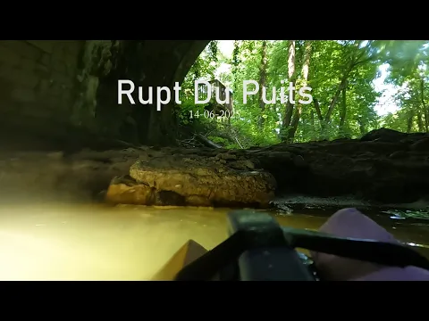
Barrois · about 4 km from L'Isle-en-Rigault
Réseau du Rupt-du-Puits – forage (siphons amont)
- Max depth6 m
- CertificationFull cave
- Water temperature≈ ~11.5 °Cestimated, no reports yet
- SpecialSidemount
Diving and fills
Dive here with
No dive centre guides here yet. Do you dive here with guests? Add your centre for free →
What it looks like
All 1 videos and posts
Videos and posts
From other divers, via YouTube, Instagram and Facebook. They only load when you click; after that, Google's or Meta's privacy rules apply.
Search for more onYouTube ↗Instagram ↗Facebook ↗
Other people's footage, not advice: how someone else dives here says nothing about what suits your team. Dive within your training.
The dive
This is an expedition dive: you go down the borehole, carry the kit 1.2 km along a large river passage, then dive long, shallow sumps. The water is 11.5 °C (1967).
Profile and sections
This is an expedition dive: you go down the borehole, carry the kit 1.2 km along a large river passage, then dive long, shallow sumps. The water is 11.5 °C (1967). Caving clubs also use the borehole for dry trips, with muddy water and lots of crawling.
The connection with the Béva was made in 2003 by a Belgian cave diver. On that side there are ~800 m of awkward low passage, a flat-out crawl and a 30 m pitch. The system is a ZNIEFF and borders the Trois-Fontaines Natura 2000 site.
- Depth and profile
- From the borehole 1,200 m of river passage to upstream S1 20 m / -2 · S2 430 m / -4.5 (restriction under a boulder choke at 400 m) · S3 1,500 m / -6 to the Béva (given as 1,770 m since 2016). On the Béva side another 1.2–1.6 km of river to the shaft. About 2,950 m underwater in the whole system.
- Configuration
- Sidemount (restriction in S2). Everything has to go down a narrow borehole and 1.2 km along the river: light, compact kit and a carrying team (estimate).
- DPV: DPV possible (estimate)
- S3 is long and shallow, but a scooter has to go down the borehole and 1.2 km along the river, and S2 has a restriction: little gain for the effort (estimate).
Who can dive where
- At least Full cave
- Configurations: Backmount / twinset / Sidemount / CCR / Small cylinders / no-mount (speleo sumps)
- Goes down to 6 m (trimix or deco may be needed)
- Ropework (SRT) needed
- Experienced divers only
This is how the planner decides who in your team may dive this cave. Rules your own trip adds (organizer, a mail, the AI) show with your trip.
How to get there
Locked borehole of ~45–50 m (Ø 80–85 cm) owned by the ONF (French state forestry office) near Robert-Espagne; descend on rope or ladder. The key is kept at the Maison lorraine de la spéléologie in L'Isle-en-Rigault (+33 3 29 71 30 12) and is available to any caver licensed in a European federation, under a convention between the Ligue Grand Est de Spéléologie and the ONF; you get it in exchange for your federation card. Arrange with the manager beforehand. Other entrance: the Gouffre de la Béva (Trois-Fontaines-l'Abbaye, Marne), a 40 m shaft; the Trois-Fontaines forest is also covered by a Ligue convention.
Around Réseau du Rupt-du-Puits – forage (siphons amont)
FillsNo fill station known nearby
The links to Booking.com are affiliate links: if you book through one, DiveTripPlanner earns a small commission. You pay the same.
Going to the Barrois with your team?
Marcel finds the sites that match your team's certifications.
Plan a trip