
Hérault and Gard · about 39 km from Nant
Source de Burle
Closed to divers
Drinking-water intake: Sainte-Énimie's pumps draw straight from the spring pool, so the water is off limits. Diving only with the municipality's permission, which the FFS divers got as an exception. The municipality wants to open the spring to cave diving later, once the pumps have been moved into the cave, a major job (FFS, 2018).
- Max depth39 m
- CertificationFull cave
- SpecialExperienced divers
Diving and fills
Dive here with
No dive centre guides here yet. Do you dive here with guests? Add your centre for free →
Now at Source de Burle
What it looks like
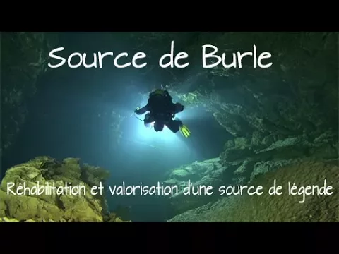
Source de Burle, réhabilitation et valorisation d'une source de légende. La source de burle - été 2020 Cave Diving - Source de Burles 2019
All 3 videos and posts
Videos and posts
From other divers, via YouTube, Instagram and Facebook. They only load when you click; after that, Google's or Meta's privacy rules apply.
Source de Burle, réhabilitation et valorisation d'une source de légende. La source de burle - été 2020 Cave Diving - Source de Burles 2019
Search for more onYouTube ↗Instagram ↗Facebook ↗
Other people's footage, not advice: how someone else dives here says nothing about what suits your team. Dive within your training.
The dive
A famous spring in the middle of Sainte-Énimie, laid out by the municipality as heritage and popular with tourists. The water is usually clear and 11.2 °C on average.
Profile and sections
A famous spring in the middle of Sainte-Énimie, laid out by the municipality as heritage and popular with tourists. The water is usually clear and 11.2 °C on average. A slope of rounded pebbles runs down against the current to the spring's boulder choke. Below it lies a fine fracture with a few windows letting in daylight, then a passage with light-grey walls and blue-grey pebbles that gradually deepens; it has featured on the cover of a technical manual and in a TV documentary. Further on you pass over blocks bristling with rock spikes: technical, carefully planned progress.
The spring has long been known for its supposed healing powers: legend says the sister of King Dagobert was cured here. It was first dived in summer 1967, but only some years later did a diver get through the boulders (200 m, -39). In 1980 divers reached 270 m, and from 1993 a side branch was found and the spring surveyed to 400 m. In 2009–2011 the Lozère GRIMP team cleared the pool with machinery, removing blocks of several tonnes. The Plongeesout team then surveyed all the passages with the municipality's permission. The flow is between 500 and 630 l/s.
- Depth and profile
- Under a boulder choke at -4 m two passages lead to a space at -6 m; an entrance shaft in a fracture to -22 m, then the main passage from -24 m to the low point at -39 m (back up to -33 at 100 m). At 125 m (-31) the cave splits into two branches: the left to a terminal choke at 210 m, the right to a choke not yet passed. 465 m in total.
- Configuration
- Not applicable: closed. Since 2011 the entrance can be passed in backmount, by two routes; the main passage is ~3 x 1.8 m, the deep part 3–4 m wide and just over 2 m high, with tighter bypasses and a narrow bedding plane at the end.
- DPV: Not DPV-suitable (estimate)
- Not applicable: closed; also short (465 m) and technical.
Who can dive where
- At least Full cave
- Configurations: Backmount / twinset / Sidemount / CCR
- Goes down to 39 m (trimix or deco may be needed)
- Experienced divers only
This is how the planner decides who in your team may dive this cave. Rules your own trip adds (organizer, a mail, the AI) show with your trip.
How to get there
In the village of Sainte-Énimie (Lozère), in a meander of the Tarn: the oblong spring pool lies between a cliff with the road above and a retaining wall; its stream joins the Tarn after a few hundred metres. The water is off limits.
Around Source de Burle
FillsNo fill station known nearby
Going to Hérault and Gard with your team?
Marcel finds the sites that match your team's certifications.
Plan a trip