
North Wales, Great Britain
Cambrian Slate Mine
- Max depth29 m
- CertificationFull cave
- Water temperature≈ ~7 °Cestimated, no reports yet
- SpecialFlooded mine or quarry
Diving and fills
Dive here with
No dive centre guides here yet. Do you dive here with guests? Add your centre for free →
What it looks like
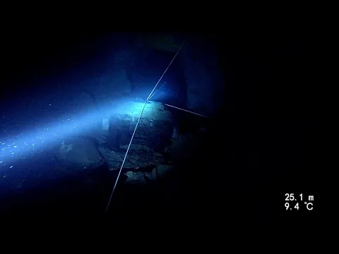
Mine Diving at Cambrian Slate Mine: 20.OCT.2023 (Full Ver) Cambrian Slate Mine Exploring the Cambrian slate mine, Glyn Ceriog, Llangollen CAMBRIAN SLATE MINE
All 4 videos and posts
Videos and posts
From other divers, via YouTube, Instagram and Facebook. They only load when you click; after that, Google's or Meta's privacy rules apply.
Mine Diving at Cambrian Slate Mine: 20.OCT.2023 (Full Ver) Cambrian Slate Mine Exploring the Cambrian slate mine, Glyn Ceriog, Llangollen CAMBRIAN SLATE MINE
Search for more onYouTube ↗Instagram ↗Facebook ↗
Other people's footage, not advice: how someone else dives here says nothing about what suits your team. Dive within your training.
The dive
Cambrian has a reasonably large dry section with several points to enter the water, and underwater large open chambers and, in places, very large passage.
Profile and sections
Cambrian has a reasonably large dry section with several points to enter the water, and underwater large open chambers and, in places, very large passage. You dive past impressive open staircases, mine carts, some still fully laden, and numerous other artefacts. The layout is less conventional than in many other mines. The water is ~7 °C and visibility 10–15 m.
The quarry west of Glyn Ceiriog was worked commercially from 1857; from 1873 the Glyn Valley Tramway took its slate to market. As the slate vein dipped deeper, underground chambers were mined, eventually on four levels. The quarry closed in the winter of 1946/47, mainly for lack of workers, and when the pumps failed the chambers below the main tunnel soon flooded. Aber Las is really part of it: a collapse has split the mine into two dive sites, each with its own entrance.
Practical: UKMC members get location maps, dive maps and surveys of the mine.
- Depth and profile
- A few small shallow areas, but most of the flooded sections lie at 16 m and 29 m (UKMC). Five dive bases, all connected eventually; lengths not published.
- Configuration
- Open-circuit cylinders get you some good dives; for the further reaches at depth TDI advises a rebreather. Sidemount is practical for the steep slope and the walk to the dive base.
- DPV: DPV possible (estimate)
- A large system with very large passage, but the scooter has to go down the steep slope and through the dry section; rules on scooters unknown.
Who can dive where
- At least Full cave
- Configurations: Backmount / twinset / Sidemount / CCR / Small cylinders / no-mount (speleo sumps)
- Goes down to 29 m (trimix or deco may be needed)
- Experienced divers only
This is how the planner decides who in your team may dive this cave. Rules your own trip adds (organizer, a mail, the AI) show with your trip.
How to get there
Open with no formal permission according to TDI (2019, updated 2021); UKMC publishes no access rule and gives its members the access agreements: check what applies now before you go. The mine lies near Glyn Ceiriog, close to Llangollen. You reach the impressive entrance down a steep, wooded and at times slippery slope; inside, a short walk brings you to one of the five dive bases (TDI).
Around Cambrian Slate Mine
FillsNo fill station known nearby
Other sites1 within 54 km
Going to North Wales with your team?
Marcel finds the sites that match your team's certifications.
Plan a trip