
North Wales, Great Britain
Croesor Slate Mine
- Max depth45 m
- CertificationFull cave
- SpecialFlooded mine or quarry
Diving and fills
Dive here with
No dive centre guides here yet. Do you dive here with guests? Add your centre for free →
What it looks like
Croesor Mine - Take 2 Croesor mine diving unexplored parts Croesor Mine - August 2019 diving in croesor slate mine 18/09/2016
All 4 videos and posts
Videos and posts
From other divers, via YouTube, Instagram and Facebook. They only load when you click; after that, Google's or Meta's privacy rules apply.
Croesor Mine - Take 2 Croesor mine diving unexplored parts Croesor Mine - August 2019 diving in croesor slate mine 18/09/2016
Search for more onYouTube ↗Instagram ↗Facebook ↗
Other people's footage, not advice: how someone else dives here says nothing about what suits your team. Dive within your training.
The dive
At Croesor you dive anything from simple shallow circuits to the deepest gallery.
Profile and sections
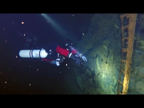
At Croesor you dive anything from simple shallow circuits to the deepest gallery. The most famous landmarks are the bridges where the shallow section crosses the deeper sections, and there are pump houses and other brick-built buildings, staircases, walls, mine carts and tools.
The quarry was worked from 1846; in 1895 Moses Kellow reopened it and modernised the work, with rock drills and a Guibal fan near the entrance of the main adit. When he started, twelve chambers were under water. The mine was worked on seven levels and closed in 1930; the three levels below the main adit, which have no natural drainage, then flooded. From the late 1940s to the early 1970s Cookes Explosives stored propellants there. The dry section still links to Rhosydd quarry and is known for the mine explorers' 'Croesor Rhosydd Through Trip'.
Practical: UKMC members get location maps, access agreements, dive maps and surveys. Croesor lies between Porthmadog and Blaenau Ffestiniog, ~1.5 h drive from the mines near Llangollen (estimate).
- Depth and profile
- Three flooded galleries, averaging 10–15 m, 27 m and 45 m deep, with many simple circuits (UKMC). Lengths not published.
- Configuration
- No public information on configurations or the way to the water (estimate). For the deepest gallery at ~45 m: trimix or a rebreather (estimate).
- DPV: unknown
- No information on lengths or the way to the water.
- Gas
- Trimix from 45 m
Who can dive where
- At least Full cave
- Configurations: Backmount / twinset / Sidemount / CCR
- Configuration unknown — research beforehand
- Goes down to 45 m (trimix or deco may be needed)
This is how the planner decides who in your team may dive this cave. Rules your own trip adds (organizer, a mail, the AI) show with your trip.
How to get there
No access rule published, but according to TDI all underground sites in the UK have access requirements. Check what applies before you go. The mine lies near the small village of Croesor in Gwynedd and is difficult to reach with anything but a decent 4x4 (UKMC).
Around Croesor Slate Mine
FillsNo fill station known nearby
Other sites1 within 54 km
Going to North Wales with your team?
Marcel finds the sites that match your team's certifications.
Plan a trip