
Barrois
Fontaine de la Dhuit
- Max depth16 m
- CertificationFull cave
- SpecialSidemount
Diving and fills
Dive here with
No dive centre guides here yet. Do you dive here with guests? Add your centre for free →
What it looks like
Plongée source de la Dhuit Plongée, source de la Dhuit Source de la Dhuit Plongée sout Source de la Dhuit
All 4 videos and posts
Videos and posts
From other divers, via YouTube, Instagram and Facebook. They only load when you click; after that, Google's or Meta's privacy rules apply.
Plongée source de la Dhuit Plongée, source de la Dhuit Source de la Dhuit Plongée sout Source de la Dhuit
Search for more onYouTube ↗Instagram ↗Facebook ↗
Other people's footage, not advice: how someone else dives here says nothing about what suits your team. Dive within your training.
The dive
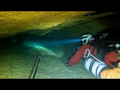
The water is clear, even in flood, which is exceptional for the area. You dive through pale limestone full of fossils (sea-urchin spines, bivalves, corals, crinoids), and groundwater amphipods (Niphargus) live here.
Profile and sections
The water is clear, even in flood, which is exceptional for the area. You dive through pale limestone full of fossils (sea-urchin spines, bivalves, corals, crinoids), and groundwater amphipods (Niphargus) live here. The floods are spectacular. The water temperature is not published.
Practical: the ideal level is 0.8–1.2 m at the Vigicrues gauge at Saucourt (Rognon). Lower means carrying between the sumps, higher means strong current.
- Depth and profile
- Three successive sumps: 34 m · 64 m · 154 m; end at -16 m in a sediment-choked fissure (2018). Earlier explored for ~400 m.
- Configuration
- The narrow entrance is hard in backmount: sidemount. At low water you carry between the sumps.
- DPV: Not DPV-suitable (estimate)
- Short sumps with carries in between: no scooter (estimate).
Who can dive where
- At least Full cave
- Configurations: Backmount / twinset / Sidemount / CCR / Small cylinders / no-mount (speleo sumps)
- Goes down to 16 m (trimix or deco may be needed)
- Experienced divers only
This is how the planner decides who in your team may dive this cave. Rules your own trip adds (organizer, a mail, the AI) show with your trip.
How to get there
From the church of Bettaincourt-sur-Rognon take the D252 towards Rochefort-sur-la-Côte, turn right before the village exit sign and continue to a hangar on the right; the entrance is in the meadow left of the road, at the foot of a small recess. Park properly and respect the fences: farm machinery uses the track, so do not come in large groups.
Around Fontaine de la Dhuit
Going to the Barrois with your team?
Marcel finds the sites that match your team's certifications.
Plan a trip